 By Courtney Meduna
Technology is being adapted for agriculture at a super speed, empowering farmers to be more targeted and precise in their operations. In fact, according to AgTech Digest, the precision agriculture market, valued at $9.4 billion in 2022, is expected to grow 12.6 percent by 2030.
Precision agriculture is a blanket term for anything that employs technology to improve crop yields and on-farm decision making. Many aspects of it are used on a broad scale today, such as auto-steer in equipment and GPS guidance. We also have section control across all types of equipment, allowing for better utilization of seed and chemistry, as well as more accurate data collection at harvest. We even now have satellite imagery, variable rate technology and (Unmanned Aerial Vehicle (UAV) adaptations (drones) to help improve efficiency.
When most growers think of precision agriculture, they tend to think of variable rate planting and application. But this technology can be hard to implement. There are professionals who specialize in creating and managing zones, however, research specific to canola seems to be limited. Another barrier is the amount of soil testing required for creating zones across a large acreage to accurately manage them. There are tools that can help growers create zones and prescription maps, including finding a local precision specialist and exploring technology software programs, such as Climate FieldView.
 Variable rate is not the only avenue growers can pursue when considering precision agriculture. In-season imagery has become a valuable tool that is broadly available with most precision software platforms. Satellite imagery is delivered to subscribers about every 7-10 days with resolution as good as 3M pixels. The downfall is that cloud cover may inhibit the images. However, good images can alert a farmer to issues happening in the field, such as insect feeding, disease presence, weed patches and more. An on/off prescription map can now be created for fungicide applications. For example, if a grower is concerned about sclerotinia in canola and wants to spray a fungicide only on areas of with dense plants and high biomass, he or she can use an in-season image to create an on/off application map for the sprayer. This enables the fungicide to be placed in the most likely spots of infection.
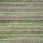
There is also an increased interest in UAV technology today with drones becoming more accessible and affordable for farmers to use in their operations. A lot of effort has been made by companies to communicate what is required to operate a UAV. Whether a drone is used to get imagery of a crop in-season for staging or to make a chemical application, it has potential to be beneficial on canola acres. UAVs would be a great tool for spot spraying weed patches or making on/off fungicide applications in-season. This would eliminate wheel tracks in the field while still allowing farmers who does not own an airplane to spray their fields themselves.
Many growers today are collecting yield data, but they may not know what to do with it. In this case, a precision agriculture specialist can be hired to analyze data and implement technology accordingly.
For emerging agricultural technologies, such as drones, AI and robotics, guidelines still need to be developed to make the best use of them. Meanwhile, established precision agricultural tools offer farmers raising canola and other crops great benefits.
Courtney Meduna is a technical agronomist at Bayer Crop Science in Minot, N.D.